The Romanian Carpathians:
A Complete Overview of Carpații Occidentali, Orientali, de Curbură, and Meridionali
What are the Romanian Carpathians?
The Romanian Carpathians (Carpații Românești) are the section of the Carpathian Mountains that lies within Romania. They form a large arc through the center of the country, wrapping around the Transylvanian Plateau, and cover roughly 31 percent of Romania’s total surface area. Because of this ring-like shape, the Romanian geographer Simion Mehedinți gave them the Latin name Coroana Montium, “the crown of mountains.”
The Carpathians are Romania’s mountain backbone. They hold the country’s highest peaks, its largest national parks, its main ski resorts, and most of its long-distance hiking trails. The highest point in the entire Romanian Carpathian chain is Vârful Moldoveanu, at 2,544 m, in the Făgăraș Mountains.
Unlike the Alps, the Romanian Carpathians are generally lower, older in places, more forested, and less glaciated, though high sections such as Făgăraș, Bucegi, and Retezat do show clear glacial landscapes: cirques, glacial lakes, and U-shaped valleys.
The four sections of the Romanian Carpathians
Most Romanian geography sources divide the Carpathians within Romania into three large branches: Carpații Orientali (Eastern Carpathians), Carpații Meridionali (Southern Carpathians), and Carpații Occidentali (Western Carpathians).
A fourth region, Carpații de Curbură (the Curvature Carpathians), is geologically and administratively treated as the southern group of the Eastern Carpathians, but it is distinctive enough in shape, geology, and hiking character that many hikers, tourism guides, and regional resources describe it as its own section.
This article follows that four-part model, since it is the most useful way to plan hikes and understand the mountains on the ground.
| Section | Position | Highest peak | Approx. max elevation | Defining feature |
|---|---|---|---|---|
| Carpații Occidentali | West, bordering the Pannonian Basin | Vf. Curcubăta Mare (Bihor Mts.) | 1,849 m | Discontinuous groups, heavy karst (caves, gorges) |
| Carpații Orientali | North and northeast, along the Ukraine border down to Valea Prahovei | Vf. Pietrosul (Rodna Mts.) | 2,303 m | Three parallel strips: volcanic, crystalline, flysch |
| Carpații de Curbură | South-central, where the arc bends sharply | Vf. Ciucaș area / Vrancea Mts. | around 1,950 m | Sharp curvature, karst gorges, flysch and conglomerate relief |
| Carpații Meridionali | South, the Alpine-like core of the range | Vf. Moldoveanu (Făgăraș Mts.) | 2,544 m | Highest, most massive, most glaciated section |
Carpații Occidentali (the Western Carpathians)
Carpații Occidentali sit west of the Transylvanian Depression, roughly bounded by the Danube to the south, the Someș River to the north, and the Barcău River to the northwest. Their defining trait is discontinuity: unlike the more continuous ridgelines of the Eastern and Southern Carpathians, the Western Carpathians break into separate massifs, split apart by wide corridors and low “gulf depressions” where the plain reaches deep into the mountains.
Geologically they are described as a “petrographic mosaic,” containing crystalline schists, limestone, volcanic rock, and sedimentary rock all in the same region. This mix produces Romania’s richest concentration of karst landscape: caves such as Peștera Urșilor, Peștera Scărișoara, and Peștera Vântului, along with numerous gorges, sit within this section.
Elevations here are the lowest of the three main branches, with the highest point at 1,849 m (Vârful Curcubăta Mare, in the Bihor massif of the Apuseni Mountains). Because the terrain is gentler and more fragmented, this is also the most densely settled part of the Romanian Carpathians, with villages and towns reaching up to about 1,600 m in places.
Carpații Occidentali are traditionally split into three major groups:
- Munții Apuseni, north of the Mureș River. This is the largest and most visited group, home to the Bihor, Vlădeasa, and Metaliferi mountains and most of the region’s show caves.
- Munții Poiana Ruscă, a central group south of the Mureș, made mostly of crystalline schist, topping out at 1,374 m (Vârful Padeș).
- Munții Banatului, in the southwestern corner of Romania, south of the Timiș corridor, including the Semenic, Almăj, Locvei, Dognecei, and Anina mountains, with the highest point at Vârful Semenic (1,447 m).
Within these three groups, Romanian geography further recognizes 18 smaller mountain sub-groups. Those sub-groups, and the individual massifs inside them, will be covered in a separate, dedicated resource.
Carpații Orientali (the Eastern Carpathians)
Carpații Orientali form the longest section of the Romanian Carpathians, running from the border with Ukraine in the north down to the Prahova Valley in the south, where they meet the Curvature Carpathians. To the west they border the Transylvanian Depression; to the east they border the Moldavian Plateau and the Subcarpathians.
Their most distinctive feature is a three-strip structure running roughly parallel to the range, from west to east:
- A volcanic strip in the west, formed by the Oaș, Gutâi, Țibleș, Călimani, Gurghiu, and Harghita mountains. This is the longest volcanic mountain chain in Europe, reaching 2,100 m at Vârful Pietrosul in the Călimani Mountains.
- A crystalline and Mesozoic strip in the center, containing the highest point of the whole Eastern Carpathians: Vârful Pietrosu, 2,303 m, in the Rodna Mountains.
- A flysch (sedimentary) strip in the east, reaching 1,907 m at Vârful Toaca in the Ceahlău massif, one of the most iconic peaks in this section.
Carpații Orientali are generally split into three groups:
- The northern group: Carpații Maramureșului și Bucovinei (the Maramureș and Bucovina Carpathians), including the Rodna, Maramureș, and Obcinele Bucovinei mountains.
- The central group: Carpații Moldo-Transilvani, including the volcanic chain and the Ceahlău, Hășmaș, and Bistrița mountains.
- The southern group: Carpații de Curbură, treated below as its own section.
Compared to the Southern Carpathians, this section has moderate elevations, broader and more numerous depressions (Prislop, Mestecăniș, Ghimeș-Palanca, Oituz, Predeal, and others), and a generally softer, more rounded relief, except where flysch and karst rock produce gorges and caves.
Carpații de Curbură (the Curvature Carpathians)
Carpații de Curbură occupy the point where the Romanian Carpathian arc changes direction most sharply, bending from the roughly north to south orientation of the Eastern Carpathians into the roughly east to west orientation of the Southern Carpathians. This group is bordered by the Prahova Valley to the west (toward the Southern Carpathians) and connects north into the Moldo-Transylvanian group of the Eastern Carpathians.
Formation here continued later than in much of the rest of the range: the folding began during the Alpine orogeny in the Cretaceous, at the end of the Mesozoic era, and continued into the Neogene, making parts of this section geologically younger than neighboring sectors.
Key characteristics:
- Strong karst relief, with caves and gorges cut into limestone and conglomerate.
- Mountain groups including the Ciucaș, Nemira, Vrancea, Baraolt, and Bodoc mountains.
- Well-known mountain passes such as Predeal (1,040 m), Oituz (866 m), and Tabla Buții.
- A landscape often described as dramatic and jagged rather than massive, in contrast to the rounded ridgelines further north or the block-like massifs of the Southern Carpathians.
Because Carpații de Curbură are administratively the southern group of the Eastern Carpathians, some official sources fold them back into a three-part model of the Romanian Carpathians. Both classifications are correct; this resource treats it separately because the geology, shape, and hiking character genuinely set it apart.
Carpații Meridionali (the Southern Carpathians)
Carpații Meridionali are the highest, most massive, and most Alpine-looking section of the Romanian Carpathians. French geographer Emmanuel de Martonne was so struck by the Făgăraș Mountains that he called them the “Transylvanian Alps” in his 1906 study of the region.
The section runs from the Prahova Valley in the east to the Cerna-Timiș-Bistra-Hațeg-Ștei-Orăștie depression corridor in the west, which separates it from Carpații Occidentali. To the north it borders the Transylvanian Depression. To the south, a major escarpment, in places dropping nearly 1,000 m, separates it from the Getic Subcarpathians and the Mehedinți Plateau.
This is where Romania’s highest terrain is concentrated. All 13 peaks in the country above 2,500 m sit in Carpații Meridionali: eight in the Făgăraș Mountains, two in Bucegi, two in Retezat, and one in Parâng. The two highest points in the country, Vârful Moldoveanu (2,544 m) and Vârful Negoiu (2,535 m), are both in the Făgăraș range.
Structurally, the Southern Carpathians are dominated by crystalline schist, which explains both their height and their massive, block-like appearance, with limestone and conglomerate appearing mainly in Bucegi, Piatra Craiului, Mehedinți, and Cernei, producing the region’s karst features. Above roughly 1,800 m, past glaciation carved out long valleys, cirques, and lakes, most famously in Făgăraș and Retezat.
Unlike the other branches, Carpații Meridionali have relatively few depressions and passes, and only two rivers, the Jiu and the Olt, manage to cut all the way through the range. This gives the section a continuous, unbroken feel compared to the more fragmented Occidentali and Orientali.
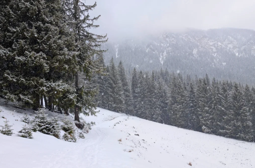
Carpații Meridionali are divided into four major groups:
- Grupa Bucegi, between the Prahova and Dâmbovița valleys, including the Bucegi, Leaota, and Piatra Craiului massifs. Highest point: Vârful Omu, 2,505 m.
- Grupa Făgăraș, the highest and most glaciated group in the country, with extensive glacial valleys and lakes such as Bâlea, Capra, and Urlea. Highest point: Vârful Moldoveanu, 2,544 m.
- Grupa Parâng, west of Făgăraș across the Olt Valley, combining glacial and karst relief. Highest point: Vârful Parângul Mare, 2,519 m.
- Grupa Retezat-Godeanu, in the west of the Southern Carpathians, home to Retezat National Park and some of the best-preserved glacial cirques in Romania. Highest point: Vârful Peleaga, 2,509 m.
How the four sections compare
Highest and most dramatic: Carpații Meridionali, especially the Făgăraș and Retezat groups.
Most fragmented and cave-rich: Carpații Occidentali, especially the Apuseni Mountains.
Longest and most geologically varied: Carpații Orientali, with its volcanic, crystalline, and flysch strips.
Most tightly folded and youngest relief: Carpații de Curbură, where the arc bends and the karst gorges of Ciucaș and Nemira sit close together.
Why this matters for hikers
If you are planning hikes in Romania, this four-way split is more than a geography lesson. It roughly predicts what kind of trail you will find:
- Head to Carpații Meridionali for high-altitude ridge hikes, glacial lakes, and via ferrata-style cabled sections (Făgăraș, Retezat, Bucegi, Parâng).
- Head to Carpații Occidentali for caves, gorges, and shorter, greener, lower-altitude routes (Apuseni, Poiana Ruscă, Banat Mountains).
- Head to Carpații Orientali for volcanic craters, long ridge traverses, and iconic single peaks like Ceahlău or the Rodna massif.
- Head to Carpații de Curbură for dramatic, compact hikes close to Brașov and the Prahova Valley, such as Ciucaș, with fast access from Bucharest or Brașov.
Frequently asked questions
How many main sections do the Romanian Carpathians have?
Traditionally three: Carpații Occidentali, Carpații Orientali, and Carpații Meridionali. Carpații de Curbură is officially the southern group of Carpații Orientali, but it is distinctive enough that it is frequently treated as a fourth section, particularly in tourism and hiking contexts.
What is the highest peak in the Romanian Carpathians?
Vârful Moldoveanu, at 2,544 m, in the Făgăraș Mountains, part of Carpații Meridionali.
Which section of the Carpathians has the most caves?
Carpații Occidentali, particularly the Apuseni Mountains, which contain Romania’s most famous show caves, including Peștera Urșilor, Peștera Scărișoara, and Peștera Vântului.
Which Carpathian section is the longest volcanic mountain chain in Europe?
The volcanic strip of Carpații Orientali, running through the Oaș, Gutâi, Țibleș, Călimani, Gurghiu, and Harghita mountains, is considered the longest volcanic chain in Europe.
How many mountain groups make up Carpații Occidentali?
Three major groups (Munții Apuseni, Munții Poiana Ruscă, and Munții Banatului), which are further divided into 18 recognized mountain sub-groups.
How many mountain groups make up Carpații Meridionali?
Four: Bucegi, Făgăraș, Parâng, and Retezat-Godeanu.