
Carpații Meridionali (the Southern Carpathians):
Complete Guide to Romania's Highest Mountains
This is part of a larger series on the mountains of Romania.
What are Carpații Meridionali?
Carpații Meridionali (the Southern Carpathians) form the highest, most massive, and most continuous section of the Romanian Carpathians. They run from the Prahova Valley in the east to the Cerna-Timiș-Bistra-Hațeg-Ștei-Orăștie depression corridor in the west, which separates them from Carpații Occidentali. To the north they border the Transylvanian Depression, and to the south a major escarpment, in places dropping nearly 1,000 m, separates them from the Getic Subcarpathians and the Mehedinți Plateau.
French geographer Emmanuel de Martonne was struck enough by the range, and by the Făgăraș Mountains in particular, to call them the Transylvanian Alps in a 1906 study of the region, a name still used in some English-language sources today.
The highest point in the entire Romanian Carpathian chain is here: Vârful Moldoveanu, 2,544 m, in the Făgăraș Mountains. All 13 peaks in Romania above 2,500 m sit in Carpații Meridionali: eight in Făgăraș, two in Bucegi, two in Retezat, and one in Parâng.
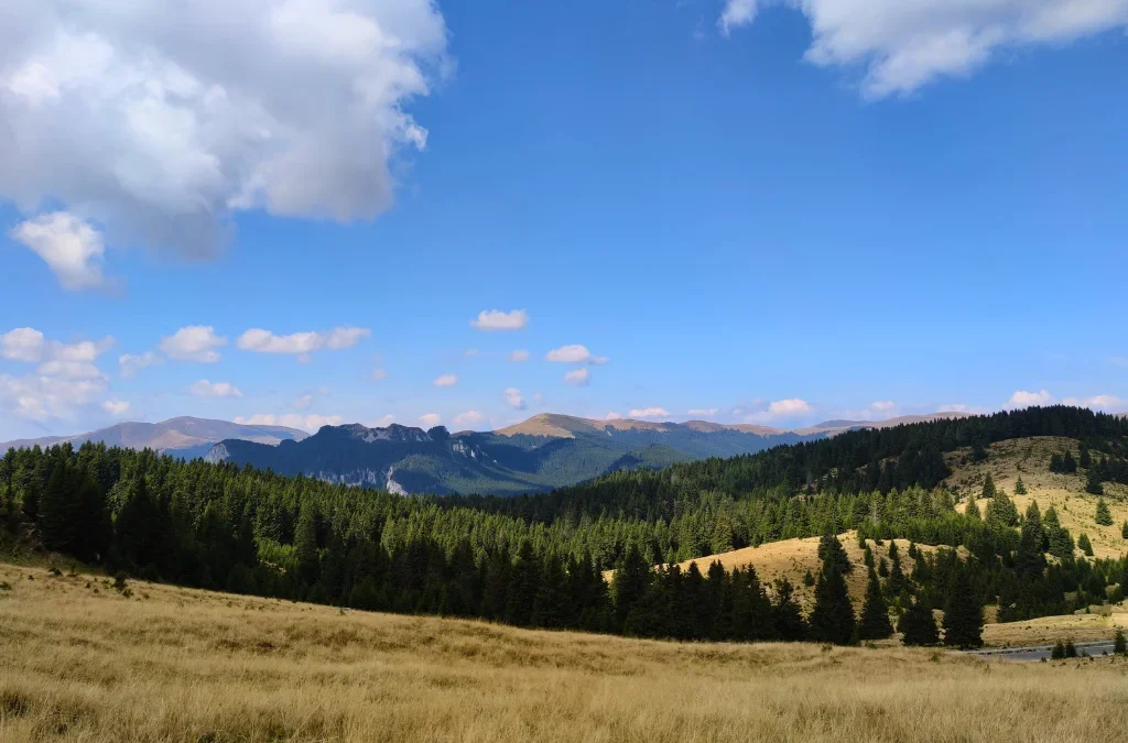
The defining characteristic: mass, height, and glaciation
Carpații Meridionali have the highest average elevation of any Romanian Carpathian section, around 1,136 m, compared to roughly 950 m in Carpații Orientali and 654 m in Carpații Occidentali. Structurally, they are dominated by crystalline schist, which gives the range its massive, block-like appearance, with limestone and conglomerate appearing mainly at the margins, in Bucegi, Piatra Craiului, Căpățânii, and Mehedinți, producing most of the range’s karst scenery.
Three broad erosion surfaces, remnants of older land surfaces later uplifted by tectonic activity, are recognized across the range: Borăscu, at 2,200 to 2,400 m, Râu-Șes, at 1,600 to 1,800 m, and Gornovița, lower still. Above roughly 1,800 m, past glaciation carved out cirques, glacial valleys, and lakes, most extensively in Făgăraș and Retezat, followed by Parâng, Godeanu, Țarcu, and Cindrel-Șureanu, and to a lesser extent Iezer-Păpușa and Leaota.
Unlike the more fragmented Occidentali and Orientali, Carpații Meridionali have relatively few depressions and passes, and only two rivers, the Jiu and the Olt, cut all the way through the range. This gives the section a continuous, unbroken feel that is part of what makes it Romania’s most visited and most photographed mountain region.
The four major groups
Carpații Meridionali are divided into four major groups, arranged from east to west:
| Group | Position | Highest peak | Elevation |
|---|---|---|---|
| Grupa Bucegi | Between the Prahova and Dâmbovița valleys | Vf. Omu (Bucegi) | approx. 2,505 m |
| Grupa Făgăraș | Between the Dâmbovița/Argeș area and the Olt Valley | Vf. Moldoveanu (Făgăraș) | 2,544 m |
| Grupa Parâng | West of the Olt, radiating from the Parâng massif | Vf. Parângul Mare (Parâng) | 2,519 m |
| Grupa Retezat-Godeanu | Westernmost group, toward Carpații Occidentali | Vf. Peleaga (Retezat) | 2,509 m |
Within these four groups, Romanian geography recognizes around 24 distinct mountain sub-groups, though the exact count varies slightly depending on whether certain smaller massifs, such as Buila-Vânturarița, are counted as fully separate sub-groups or as part of a neighboring one.
The smallest of the four groups by area, sitting between the Prahova and Dâmbovița valleys, and the closest to Bucharest and Brașov, which makes it the most visited part of Carpații Meridionali.
| Sub-group | Highest peak | Elevation |
|---|---|---|
| Munții Bucegi | Vf. Omu | approx. 2,505 m |
| Munții Leaota | Vf. Leaota | 2,133 m |
| Munții Piatra Craiului | Vf. La Om (Piscul Baciului) | 2,238 m |
Munții Bucegi themselves are capped by conglomerate rock, which has weathered into the famous Sfinxul and Babele rock formations. Munții Leaota, by contrast, is built from crystalline schist and has a rounder, gentler profile. Munții Piatra Craiului is a narrow, knife-edge limestone ridge, considered one of the most dramatic and technical hiking crests in Romania, and is protected as Piatra Craiului National Park.
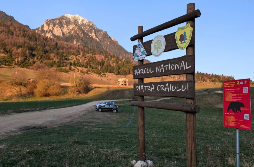
The highest and most glaciated group in the country, extending from the area between the Dâmbovița, Argeș, and Topolog rivers west to the Olt Valley, and including a southern extension along the Olt gorge as far as Cozia.
| Sub-group | Highest peak | Elevation |
|---|---|---|
| Munții Făgăraș | Vf. Moldoveanu | 2,544 m |
| Munții Iezer-Păpușa | Vf. Roșu (also cited as Vf. Iezer) | 2,462 to 2,470 m |
| Munții Cozia | Vf. Ciuha Mare (Vf. Cozia) | 1,668 m |
| Munții Ghițu | Vf. Ghițu | 1,622 m |
| Munții Frunții | Vf. Munțișor | 1,534 to 1,543 m |
| Munții Țaga (Țagla) | Vf. Țagla | 1,641 m |
Munții Făgăraș hold both the highest point in Romania, Vârful Moldoveanu, and the second highest, Vârful Negoiu, 2,535 m, along with extensive glacial relief: long U-shaped valleys and glacial lakes including Bâlea, Capra, and Urlea. The Transfăgărășan, one of Romania’s best-known mountain roads, crosses the range and connects to Lacul Vidraru, a large reservoir on the Argeș River at the range’s southern edge. Munții Cozia, at the group’s southeastern tip, is a smaller, separate massif overlooking the Olt gorge and is protected as Cozia National Park.
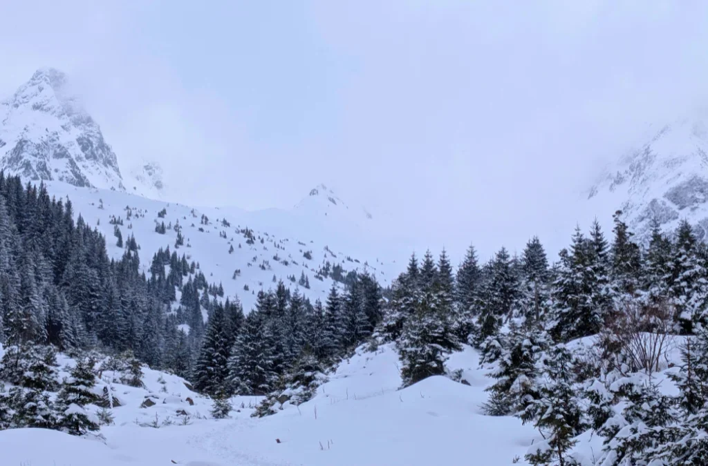
The most extensive group in Carpații Meridionali, sitting west of the Olt River, structured around the central Parâng massif with several other massifs radiating outward from it.
| Sub-group | Highest peak | Elevation |
|---|---|---|
| Munții Parâng | Vf. Parângul Mare | 2,518 to 2,519 m |
| Munții Șureanu | Vf. lui Pătru | 2,130 m |
| Munții Cindrel | Vf. Cindrel | 2,244 to 2,245 m |
| Munții Lotrului | Vf. Șteflești | 2,242 m |
| Munții Latoriței | Vf. Bora | 2,055 m |
| Munții Căpățânii | Vf. Nedeia (also cited as Vf. Ursu) | 2,124 to 2,130 m |
| Masivul Buila-Vânturarița | Vf. Vânturarița Mare | around 1,880 m |
Rivers including the eastern Jiu, the Strei, the Sadu, the Cibin, the Lotru, and the Gilort all rise from this group. Glacial lakes here include Gâlcescu in the Parâng massif, and the group’s karst areas, especially around Căpățânii, contain notable caves such as Peștera Muierii and Peștera Polovragi. Munții Șureanu, on the group’s northeastern edge, holds Sarmizegetusa Regia, the former capital of the Dacian kingdom and a UNESCO World Heritage Site. Buila-Vânturarița, a compact limestone massif, is protected as Buila-Vânturarița National Park.
The westernmost group of Carpații Meridionali, bordering Carpații Occidentali across the Cerna-Timiș-Bistra corridor, and the most extensively glaciated group after Făgăraș.
| Sub-group | Highest peak | Elevation |
|---|---|---|
| Munții Retezat | Vf. Peleaga | 2,509 m |
| Munții Piule-Iorgovanu | Vf. Piule | 2,081 m |
| Munții Tulișa | Vf. Tulișa | 1,792 m |
| Munții Godeanu | Vf. Gugu | 2,291 m |
| Muntele Mic | Vf. Muntele Mic | 1,802 m |
| Munții Țarcu | (shared ridge with Godeanu and Muntele Mic) | over 2,000 m |
| Munții Cernei | Vf. Dobrii | 1,928 m |
| Munții Vâlcan | Vf. Oslea | 1,946 m |
| Munții Mehedinți | Vf. lui Stan | 1,466 m |
Munții Retezat contains some of the best-preserved glacial cirques and lakes in Romania, including Lacul Bucura, the largest glacial lake in the country by surface area, and Lacul Zănoaga, the deepest. The range is protected as Retezat National Park, established in 1935 as Romania’s first national park and later recognized as a UNESCO Biosphere Reserve. Munții Vâlcan and Munții Cernei border Munții Poiana Ruscă and the Danube corridor respectively, while Munții Cernei extends toward Domogled-Valea Cernei National Park, near Băile Herculane.
Protected areas across Carpații Meridionali
Carpații Meridionali hold some of Romania’s oldest and best-known protected areas, including Retezat National Park, Piatra Craiului National Park, Bucegi Natural Park, Cozia National Park, Buila-Vânturarița National Park, Defileul Jiului National Park, and Domogled-Valea Cernei National Park.
Why this matters for hikers
Carpații Meridionali are, by a wide margin, Romania’s most popular hiking destination, and the four groups suit noticeably different trips:
- High alpine ridge hiking: Făgăraș and Retezat, for long multi-day traverses, glacial lakes, and Romania’s highest summits.
- Technical and rock-focused hiking: Piatra Craiului, for its knife-edge limestone ridge, and Bucegi, for the Sfinxul and Babele formations and its network of cable cars and mountain huts.
- Quieter, high-plateau hiking: Parâng and Cindrel-Șureanu, which combine alpine terrain with easier access than Făgăraș or Retezat.
- Cultural and historical hiking: Șureanu, for Sarmizegetusa Regia, and Cozia, for its monastery and views over the Olt gorge.
- Karst and gorge hiking: Căpățânii and Buila-Vânturarița, for caves and limestone canyons, and Defileul Jiului, on the border between the Parâng and Retezat-Godeanu groups.
Frequently asked questions
What is the highest peak in Carpații Meridionali, and in all of Romania? Vârful Moldoveanu, 2,544 m, in the Făgăraș Mountains.
How many major groups make up Carpații Meridionali? Four: Grupa Bucegi, Grupa Făgăraș, Grupa Parâng, and Grupa Retezat-Godeanu.
How many mountain sub-groups are there in Carpații Meridionali? Around 24, though the exact count varies slightly by source depending on how a few smaller massifs, such as Buila-Vânturarița, are classified.
Where are all of Romania’s peaks above 2,500 m located? All 13 are in Carpații Meridionali: eight in Făgăraș, two in Bucegi, two in Retezat, and one in Parâng.
What is Romania’s oldest national park? Retezat National Park, established in 1935, part of the Retezat-Godeanu group.
Why are Carpații Meridionali sometimes called the Transylvanian Alps? French geographer Emmanuel de Martonne used the term in a 1906 study, struck by the scale and glacial character of the Făgăraș Mountains in particular. The name is still used occasionally in English-language sources today.